A primary goal of this master plan was to strengthen connectivity on campus and to the surrounding neighborhoods in support of the Imagine Kalamazoo 2025 Plan. To do this, the plan proposes enhanced crossing at key locations on W. Michigan Avenue, West Main Street and Academy Street to improve safety and ease of crossing along with the addition of new sidewalks along Lovell Street and increased pedestrian realm along W. Michigan Avenue. As these are all public streets, K College will need to work with the City of Kalamazoo to achieve these improvements to pedestrian circulation.
The addition of banner poles, lighting, architectural features, special pavement, and landscape upgrades are recommended along the campus edges to enhance campus identity and improve pedestrain experience from main campus and through the neighborhood to the Athletics Complex.
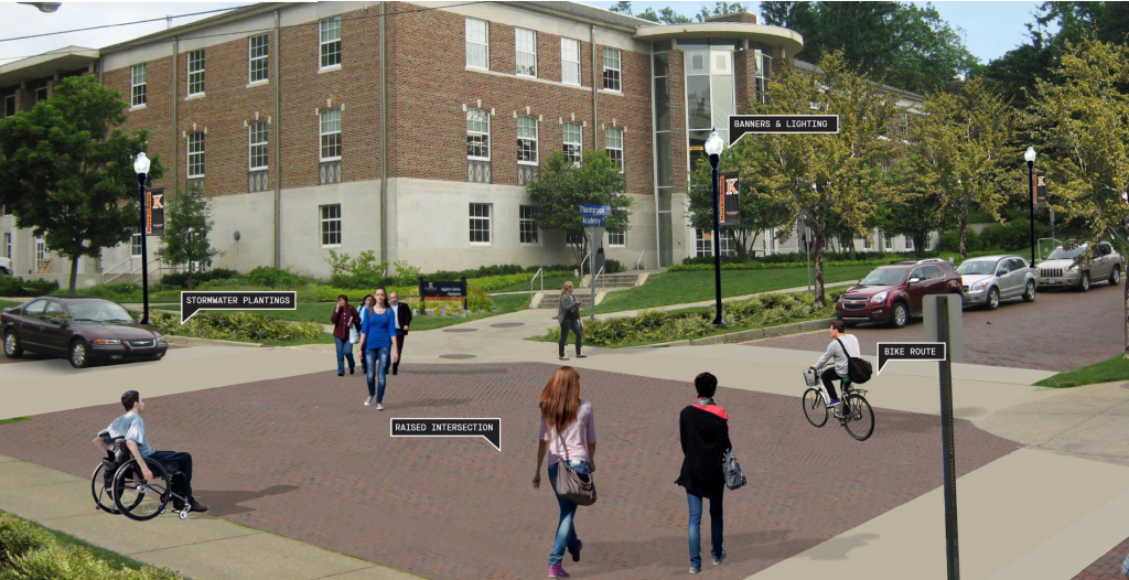
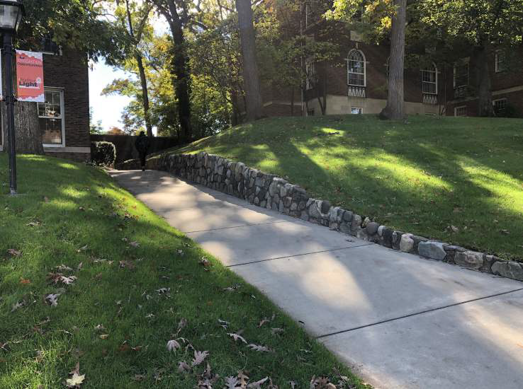
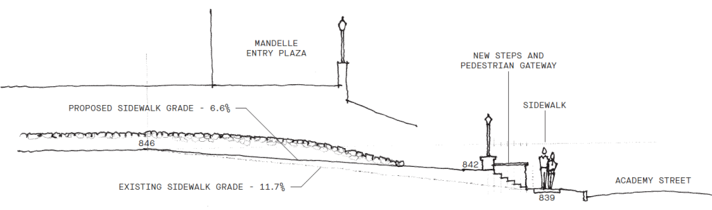
The Master Plan recommends changes to create accessible options for navigating the topography of campus.
The following pages illustrate these recommendations and act as a guidelines for pedestrian circulation on campus and along it’s edges.
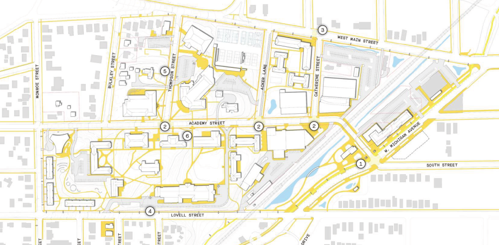
Key improvements to campus connectivity include:
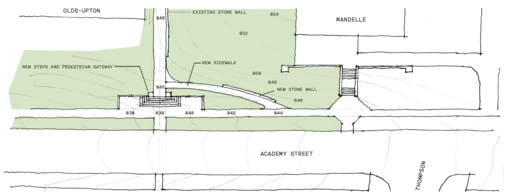
- New Academy Street Gateway
- Academy Raised Intersections
- West Main Mid-Block Crossing
- Lovell Street Sidewalk
- Thompson Accessibility Upgrades
- Academy Accessibility Upgrades
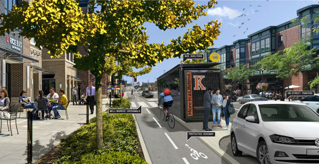
Possible Improvements to W. Michigan Avenue
The Master Plan recommends rerouting Academy Street to create a more regular intersection with a narrowed W. Michigan Avenue. The new configuration lends itself to a new gateway entrance to campus, traffic signals, and safer, well-marked crossings. Upgrades to W. Michigan Avenue will follow the Street Design Guidelines released by the City of Kalamazoo.
New development should be mixed use with an active ground floor. Areas dedicated to outdoor seating should be planned for along with wider sidewalks set back from the roadway, buffered by planted areas with campus identifying features.
Bike and transit infrastructure should be integrated along with on-street parking to support the neighborhood node.
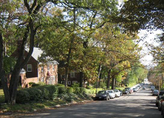
Possible Improvements to Academy Street
The intersections of Academy with Thompson Street, Acker Lane, and Catherine Street were all identified as safety concerns for the campus community. The addition of raised speed tables at these key intersections could help slow traffic and further prioritize the pedestrian. The intersection should be raised to the elevation of the sidwalk and utilize the same brick pavement with an alternate paving material to ramp up from existing street grade to the speed table. These sections of inclined pavement should be contrasting to signal a change in grade but complimentary to maintain existing character of Academy Street.
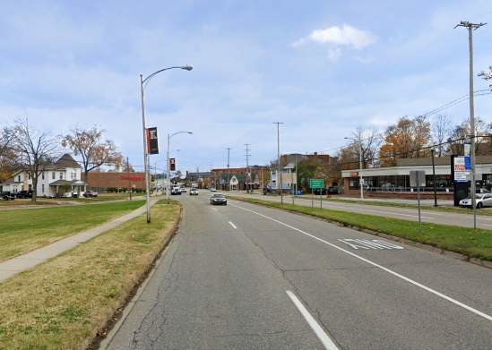
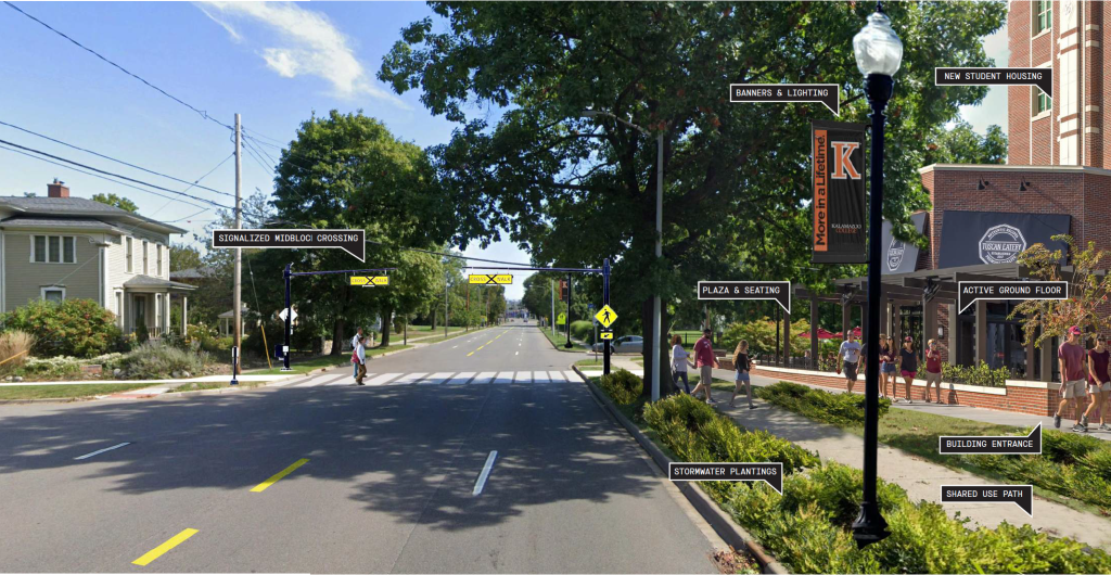
Possible Improvements to West Main Street
The northern edge of campus currently lacks identity and is bordered by the fast moving traffic of West Main Street. The City has plans to convert current one-way traffic into two-way. The Master Plan identifies the addition of a signalized midblock crossing at Stuart Avenue to create a safer condition to link campus to the Stuart Neighborhood. The crossing should be illuminated and feature push button activation of a rapid flashing beacon.
The New West Main Residence Hall should have an active ground floor with plaza space for outdoor gathering. The addition of light poles with banners will help to improve identity along this edge.
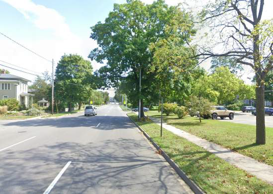
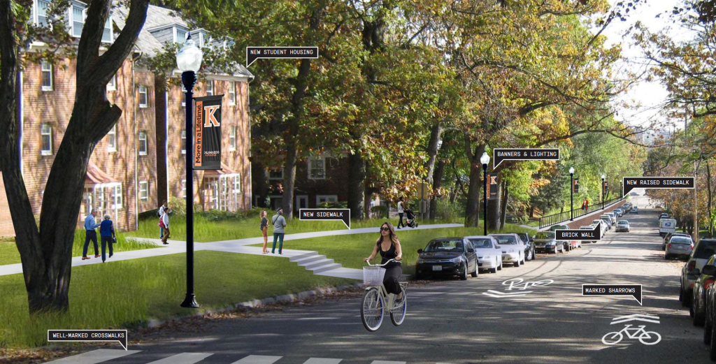
Possible Improvements to Lovell Street
In order to improve identity and sense of arrival, the lower portion of Lovell Street where it meets W. Michigan Avenue would be reverted to a two-way. The addition of shared lane markings for bicycles will help to establish this bike route into the neighborhood and improve safety for cyclists. A new sidewalk should be added to the southern edge of campus along Lovell Street and the west edge of campus along Monroe to improve connectivity for both campus community and neighbors alike. Create well-marked crosswalks across W. Lovell Street south and across Monroe Street to the west to create safer connections. New banners and lighting, brick walls, and beautified landscaping will define the campus edge.
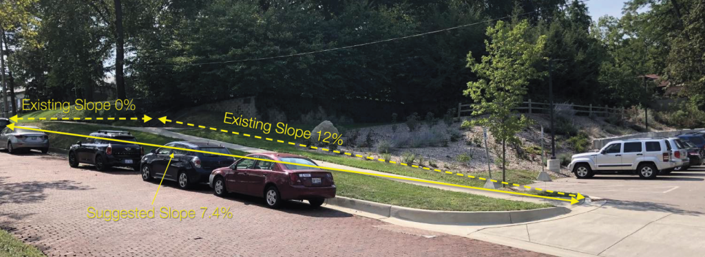
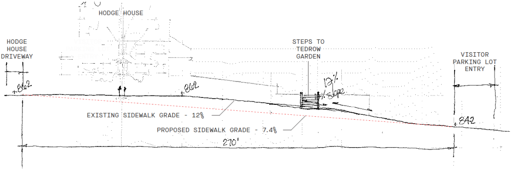
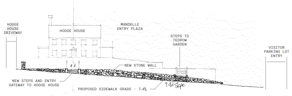
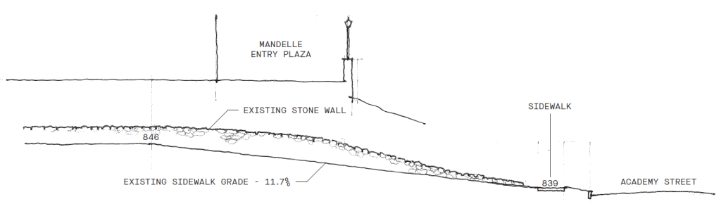
Possible Improvements to Academy Street Accessibility
Pathway Design Goals:
- Reduce severity of sidewalk slope (not necessarily ADA)
- Minimize disturbing the existing stone wall – a positive component of K’s campus character
- Build on the architectural lines and forms of Mandelle entry plaza and archway
- Continue K’s tradition of building pathways that lay softly on the landscape
Possible Improvements to Thompson Street Accessibility
Pathway design goals:
- Reduce severity of sidewalk slope (not necessarily ADA)
- Use natural stone materials – a positive component of K’s campus character
- Build on the character of sidewalks within the neighborhood – low stone retaining walls
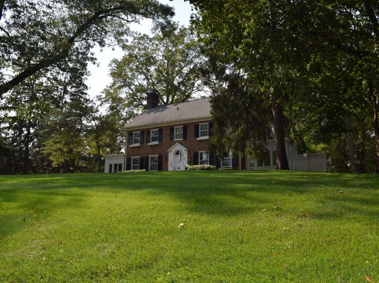
- Brings the President’s house into the campus fold
- Maintain access to Tedrow Garden