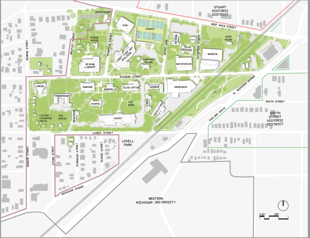
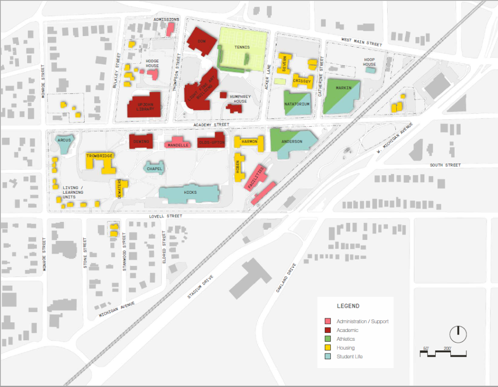
The following illustrates the existing conditions of Kalamazoo College as of 2022 including building footprints; heights and gross floor area; land and building uses; and existing roads, sidewalks, parking, and general landscape features.
Existing Campus Plan
The 45-acre campus is situated on the side of a hill on the western edge of downtown Kalamazoo, Michigan. In addition to the main campus, a 22-acre outdoor athletic facility is remotely located several blocks to the southwest. The college also owns approximately 140 acres of land in Oshtemo Township 6 miles west of campus. This land was not included in the Planning Process.
Landlocked by stable residential neighborhoods, most of which are located in various historic districts, K College currently has limited opportunities to expand the campus boundary. Adjacency to Western Michigan University, however, affords potential for sharing of resources and collaboration.
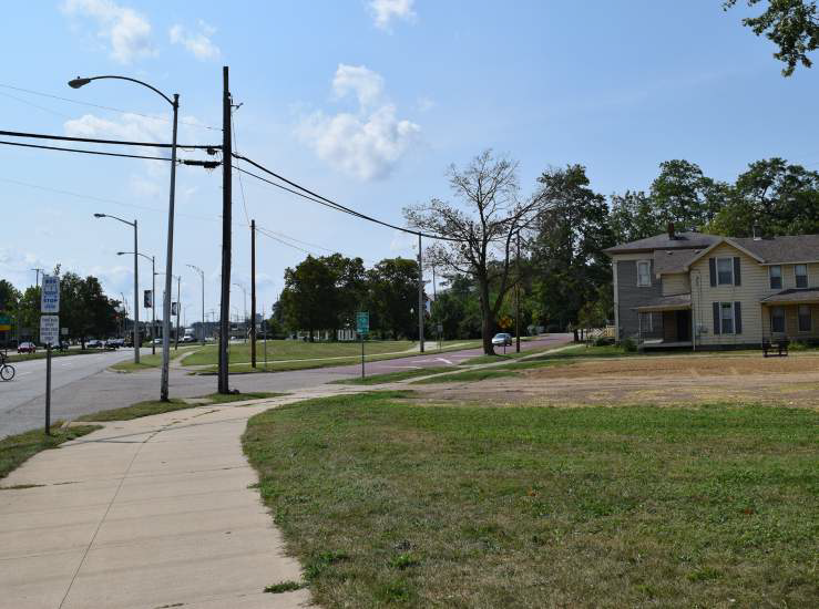
Bordered by busy streets, safety and connectivity are campus concerns shared by neighbors. The City’s Imagine Kalamazoo 2025 planning efforts to redesign streets create the opportunity for K College to enhance it’s campus edges and strengthen connections.
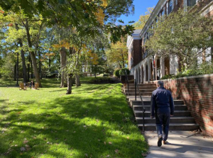
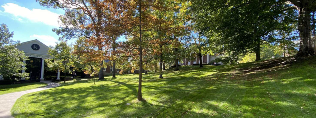
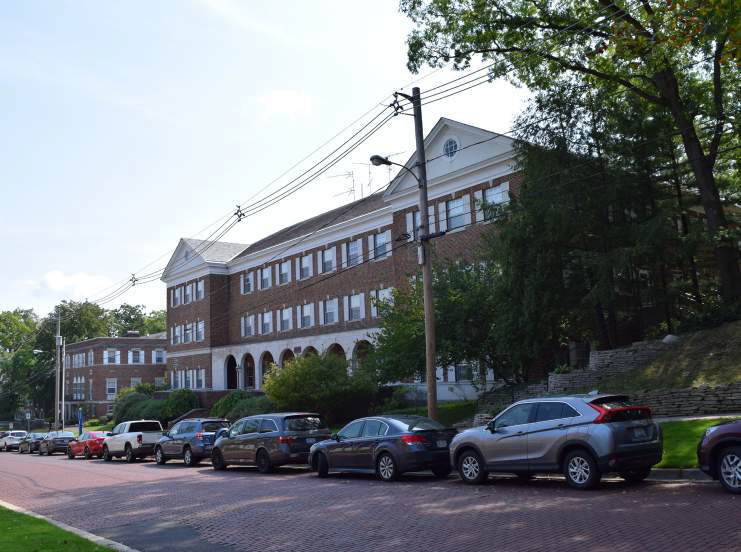
The campus structures of K College were constructed in varying interpretations of Georgian architecture with newer facilities taking on a more contemporary style. The academic core of the campus is organized around a well-defined campus green. Of the 24 primary buildings on K’s campus, several of them are located around the historic academic core. The physical connections of campus breakdown to the north.
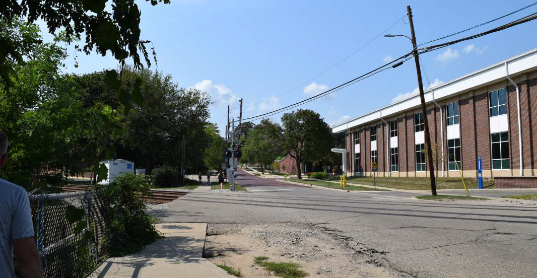
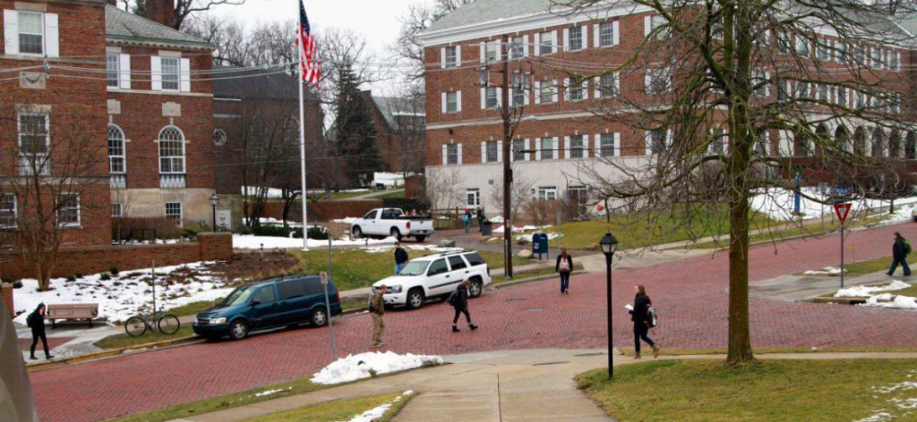
Academy Street bisects campus and plays an important role in K’s daily culture. The two-way street pattern provides for vehicular access into campus as well as local neighbors passing through. It also forms the main campus gateway as it intersects W. Michigan Avenue creating a poor arrival experience.
Additional information regarding K’s facilities can be found in the following sections.
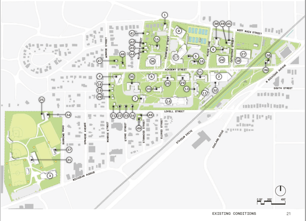
Building Analysis
| Number | Name | Stories | Max Height | Gross Area |
|---|---|---|---|---|
| 1 | Admissions Center | 2 | 30.0’ | 6,100 sf |
| 2 | Anderson Athletic Center | 2 | 39.3’ | 47,054 sf |
| 3 | Athletic Complex Fieldhouse | 2 | 44.5’ | 25,480 sf |
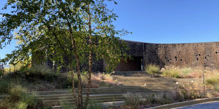
| 4 | Arcus Center for Social Justice | 1 | 18.0’ | 10,000 sf |
| 5 | Carriage House | 1.5 | 20.0’ | 1,338 sf |
| 6 | Crissey Residence Hall | 4 | 44.0’ | 31,228 sf |
| 7 | DeWaters Residence Hall | 5 | 59.1′ | 33,155 sf |
| 8 | Dewing Hall | 4 | 64.9’ | 46,374 sf |
| 9 | Dow Science Center | 3 | 62.6’ | 62,500 sf |
| 10 | Fitness & Wellness Center | 2 | 150’ | 28,842 sf |
| 11 | Facilities Management Building | 2 | 25.6’ | 18,350 sf |
| 12 | Harmon Residence Hall | 3 | 42.2’ | 35,582 sf |
| 13 | Hoben Residence Hall | 3 | 40.6’ | 28,034 sf |
| 14 | Hicks / Wells Student Center | 2 | 43.6’ | 78,000 sf |
| 15 | Hodge House (President’s House) | 2 | 31.9’ | 5,950 sf |
| 16 | Humphrey House | 2 | 38.0’ | 6,000 sf |
| 17 | Light Fine Arts | 3 | 41.7’ | 73,000 sf |
| 18 | Living / Learning House | 2 | 27.2’ | 1,750 sf |
| 19 | Living / Learning House | 2 | 27.2’ | 1,880 sf |
| 20 | Living / Learning House | 2 | 27.2’ | 1,750 sf |
| 21 | Living / Learning House | 2 | 30.2’ | 2,010 sf |
| 22 | Living / Learning House | 2 | 27.2’ | 1,880 sf |
| 23 | Living / Learning House | 2 | 20.8’ | 1,750 sf |
| 24 | Living / Learning House | 2 | 31.7’ | 1,880 sf |
| 25 | Maintenance Building | 1 | 18.9’ | 3,018 sf |
| 26 | Mandelle Administration | 3 | 42.7’ | 27,441 sf |
| 27 | Markin Racquet Center | 1 | 34.2’ | 35,000 sf |
| 28 | Natatorium | 2 | 136’ | 29,606 sf |
| 29 | Olds / Upton Science Hall | 3 | 65.6’ | 58,979 sf |
| 30 | Severn Residence Hall | 4 | 42.6’ | 30,390 sf |
| 31 | Stadium Services Building | 2 | 33.4′ | 4,515 sf |
| 32 | Steam Plant | 1 | 20.0’ | 3,500 sf |
| 33 | Stetson Chapel | 1 | 116.5’ | 9,113 sf |
| 34 | Storage Building | 1 | 14.9’ | 2,068 sf |
| 35 | Trowbridge Residence Hall | 4 | 50.9’ | 56,305 sf |
| 36 | Upjohn Library Commons | 3 | 49.1 | 101,000 sf |
| 37 | Visitors Restrooms | 1 | 15.2’ | 398 sf |
| 38 | 812 Academy St. Residence | 2 | 24.6’ | 3,530 sf |
| 39 | 818 Academy St. Residence | 2 | 31.2’ | 3,190 sf |
| 40 | 1324 Academy St. Residence | 2 | 26.5’ | 1,710 sf |
| 41 | 115 Bulkley St. Residence | 2 | 26.3’ | 2,620 sf |
| 42 | 129 Bulkley St. Residence | 2 | 26.2’ | 2,150 sf |
| 43 | 133 Bulkley St. Residence | 2 | 31.6’ | 2,750 sf |
| 44 | 139 Bulkley St. Residence | 2 | 29.0’ | 2,340 sf |
| 45 | 114 Catherine St. Residence | 2 | 29.5’ | 3,480 sf |
| 46 | 116 Catherine St. Residence | 2 | 26.7’ | 2,750 sf |
| 47 | 143 Monroe St. Residence | 2 | 29.5’ | 1,710 sf |
| 48 | 204 Stanwood St. Residence | 2 | 23.0’ | 1,404 sf |
| 49 | 208 Stanwood St. Residence | 2 | 23.0’ | 1,421 sf |
| Total Gross Building Area | 940,275 sf |
Campus Front Door
The designated entry at Academy and W. Michigan is confusing to visitors. Also the first impression along Academy is of building backs, utility lines and the rail road.
- There does not exist a visible “front door” to campus.
- Improve entry sequence from W. Michigan Avenue.
- Entry signage / gateways could be enhanced
Campus Edges
- Campus edges are not well defined, N, S, E and W.
- The campus is hidden from the outside.
- Identification banners are located on the interior of campus but not along the public edges.
- Where does campus begin and end?
- There is opportunity along Lovell for image enhancement/ visibility.
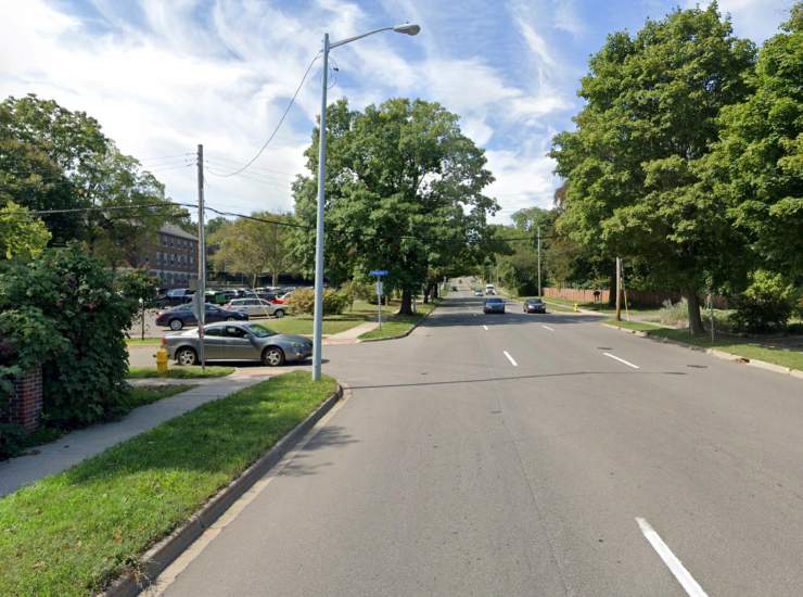
- West Main Street has fast moving traffic which is a significant barrier to the north campus edge.
- W. Michigan Avenue is fast moving and wide. Cannot cross in one light.
- Opportunities to improve connectivity and safety of crossing.
Campus Quad
- Wonderful scale.
- Mature trees / tall canopy.
- Beautifully maintained.
- Well-defined campus center.
- Buildings strongly engage.
- Topography may inhibit interaction.
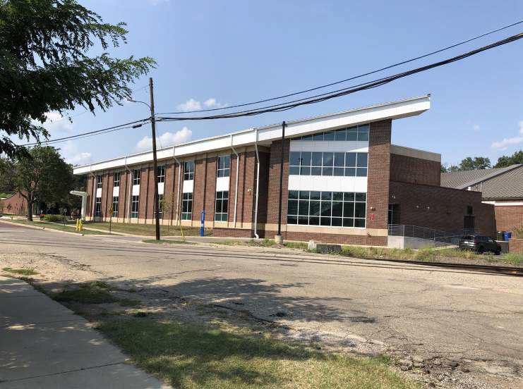
Northeast Quadrant
- For many visitors to K, this area of campus is the first they will experience, yet it is perhaps the weakest physically and aesthetically.
- The buildings in this area are in many ways different from those in the historic core of campus.
- The buildings are, in general, larger in scale with few windows therefore limited transparency of function.
- Facilities like Anderson and Markin are stylistically out of sync with the Georgian style that proliferates campus whereas, in the historic core, buildings connect and interact; these seem isolated and lack connectivity
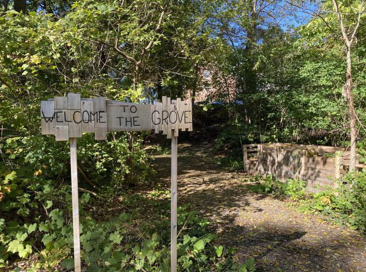
The “Grove”
- The “Grove” is an area of untapped potential.
- It has a wonderful scale and provides a good transition from campus to community.
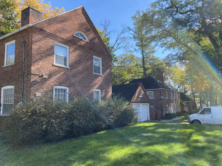
- The small theme housing along Monroe and Lovell is a great scale and fits well in the neighborhood.
- These facilities do, however, require consistent maintenance.
- Potential for greater density to house more students.
- Wooded area currently utilized by K’s composting program.
- Potential opportunity to create a learning environment with an outdoor classroom and educational signage to support current and future programming of the space.
Academy Street
- The street serves as the primary campus organizing element.
- Academy Street is center of campus activity for both vehicles and pedestrians.
- Some traffic calming measures would increase the connectivity of north and south campus.
- The red brick street is a signature of K and should be included on other areas of campus where possible.
- Potential for rerouting the street to create a more regular intersection with W. Michigan Avenue and a stronger gateway moment.
Land and Building Use
- The Academic Core is generally organized around the corner of Thompson and Academy.
- Housing is generally at the perimeter but not accessible from the campus core.
- Athletic / Recreation buildings are colocated in the northeast portion of campus.
- The athletic fields, while a few blocks away, are also grouped together.
- Hicks Center is in a good location central to most student housing.
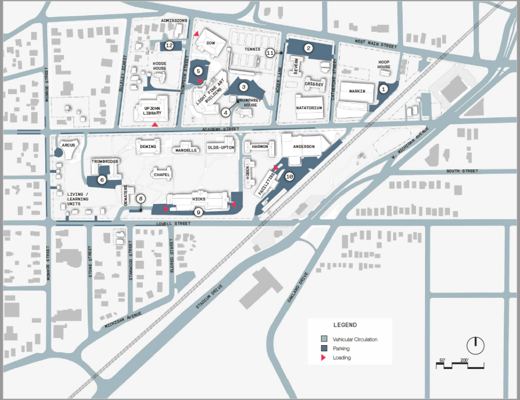
Parking and Loading
| Number | Lot | Capacity |
|---|---|---|
| 1 | Markin | 24 |
| 2 | Crissey / Severn | 91 |
| 3 | Lower Fine Arts | 46 |
| 4 | Humphrey House | 3 |
| 5 | Upper Fine Arts | 48 |
| 6 | Trowbridge | 50 |
| 7 | Living / Learning House Driveways | 8 |
| 8 | DeWaters | 10 |
| 9 | Hicks | 47 |
| 9a | Olds – Upton – Accessible | 1 |
| 10 | Anderson / Facilities Management | 69 |
| 10a | Anderson – Accessible | 2 |
| 11 | Acker Lane | 46 |
| Total Off-Street | 482 | |
| Academy Street | 74 | |
| Catherine Street | 14 | |
| Bulkley Street | 11 | |
| Lovell Street | 26 | |
| Monroe Street | 12 | |
| Thompson Street | 22 | |
| Total On-Street | 159 | |
| Total Parking Available | 549 |